Showing posts with label Indiana State Park Series. Show all posts

Thursday, May 16, 2019

Sample Chapter - A Guide to Indiana State Parks - Civilian Conservation Corps (CCC)


A Guide to Indiana State Parks -
Civilian Conservation Corps (CCC)
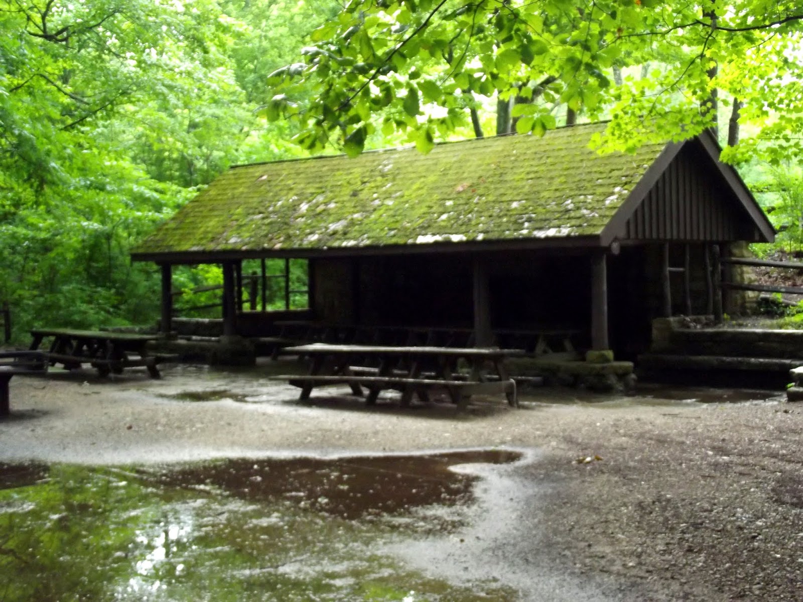
The Civilian Conservation Corps built many of the trails, shelters and other facilities in the earlier state parks during the Depression years of the 1930’s.
History of the Civilian Conservation Corps
Established by executive order on April 5, 1933 by President Franklin D. Roosevelt, the CCC served as one of the most important parts of Roosevelt's New Deal program to deal with the high unemployment during the Great Depression. The United States Army helped provide transportation for the men that would work on environmental conservation projects around the United States. By July 1, 1933, the CCC had established 1433 camps around the country, providing jobs for 300,000 men. By 1935, the CCC would have 2600 camps with almost three million workers. The CCC built 97,000 miles of roadway, planted 2.3 billion trees, developed 800 state parks and over 13,000 miles of hiking trails in those parks. Additionally, the men of the CCC stocked lakes and rivers with over one million fish and constructed 3470 fire towers. To enlist in the CCC the men had to be United States citizens, in good physical shape, single and between the ages of 17 and 23. The CCC later increased this age to 26. The monthly pay was $30.00 per month. They had to send $25.00 per month home to their families. The CCC added an educational program, which enabled over 40,000 illiterate men to learn to read and write.

Sample Chapter - A Visit to Dunes State Park - JD Marshall Underwater Nature Preserve

JD Marshall Underwater Nature Preserve


A Visit to Indiana Dunes State Park
On June 11, 1911, the ship JD Marshall sank in stormy seas just offshore of Dunes State Park. Four sailors died in the tragedy. The sunken ship still lies there, just offshore, its historic artifacts preserved by statute as the JD Marshall Underwater Nature Preserve.
JD Marshall
The JD Marshall was built in 1891 in South Haven, Michigan. The ship had a beam of thirty-three feet and a draft of twelve feet. The ship had originally hauled lumber and industrial goods from port to port in the Great Lakes. The ship had been converted to a barge to suck sand from the lake bed and haul it to port to use for construction. Historians believe the boat had 1000 tons of sand on board when it capsized.
The Wreck
The JD Marshall had been dispatched to salvage the wreck of the Muskegon, which had been in the dock at Michigan City. The Muskegon had caught fire and sank on June 10, 1911. The ten man crew of the JD Marshall had completed the salvage job and had anchored just offshore to patch a leak that had occurred. Three men dove into the water to repair the leak. An unexpected squall created twenty-foot waves, which overturned the loaded ship. The three divers drowned. Captain Leroy Rand escaped and swam to shore. He commandeered a boat to use as a lifeboat to save the rest of the crew. He managed to save five crew members. Rescuers found the first mate, Martin Donohue, dead.
JD Marshall Underwater Nature Preserve
The 100-acre nature preserve is Indiana's first underwater nature preserve. Intended to promote understanding about the JD Marshall and other Indiana shipwrecks, the Preserve offers archeological protections to the site.  DNR staff mark off the boundaries with buoys seasonally at the four corners, with additional markers along the north boundary. Boats are forbidden to drop anchor within the boundary to prevent anchors snagging and destroying underwater artifacts. DNR staff conducts periodic interpretation programs about the site throughout the year. Visitors can see a display of a reconstructed pilothouse as well as artifacts from the boat at the Nature Center in the park. For more information, contact Dunes State Park.
Link to Site
https://www.in.gov/dnr/parklake/files/sp-JDM_FAQ.PDF

Sample Chapter - A Visit to Chain o' Lakes State Park -Chain o' Lakes State Park History

Chain o' Lakes State Park History

A Visit to Chain o' Lakes State Park
The massive ice sheets that covered most of North America during the Pleistocene Epoch, which lasted from approximately 2,588,000 to 11,700 years ago, formed the terrain that makes up Chain o' Lakes State Park. This event, commonly called the Ice Age, formed the landscape of northern Indiana, Illinois, Ohio and the rest of the Great Lakes states. The movement of the ice created the chain of kettle lakes that form the chain in the park.
Kettle Lake
Retreating glaciers form kettle lakes when they calve huge ice blocks. These massive blocks break away and carve depressions in the soft ground adjacent to the retreating glacier. When the ice melts, they leave behind shallow lakes that fill with sediment. Sudden breakage of an ice-dammed lake can also create a kettle lake. These lakes are seldom deeper than about thirty feet.
Chain o Lakes
The lakes in the state park formed between 13,000 and 14,000 years ago. Waters melting from the retreating glaciers carved the channels that connect the lakes.
Settlement
The Miami and Potawatami tribes inhabited the area at the time of white settlement. They had a village on the north shore of Indian Lake, now called Bowen Lake. The lake derives its name from the first settler, William Bowen.
William E. Bowen (Feb. 7, 1810 - May 5, 1881)
The son of Jonathan Bowen and Catherine Ermentrout, William was native to Lebanon in Berks County, Pennsylvania. He and Elizabeth Whitesell married in 1831. The couple would have seven children. The Bowens moved to Noble County in 1837, inhabiting the area now included in Chain O' Lakes State Park. William constructed a cabin on the north shore of Indian Lake in 1840. Bowen would serve as township justice of the peace, county sheriff and treasurer of Noble County. He and his wife are interred at Albion Cemetery.
Stanley School House

Constructed in 1915, the school is the fourth schoolhouse to occupy the site. The first structure, a log building, was built around 1845. A wood frame structure replaced the log one in 1855. This school burned down in 1880 and was replaced by a brick schoolhouse. This one burned down also and the current schoolhouse replaced it in 1915. It was common practice at the time to name a schoolhouse after a nearby farmer, thus the Stanley Schoolhouse derives its name from local farmer, Henry Stanley. The school remained open until closing in 1954. It was the last one room schoolhouse in Noble County and possibly one of the last ones in Indiana. After closing, the school stood vacant until Chain o' Lakes State Park opened in 1960. The park initially used it as a nature center until 2011. The National Register of Historic Places listed the schoolhouse in 2015, after the park restored it to its original appearance. 
Park Development
The precursor of the Department of Natural Resources, the Department of Conservation, recommended that the area around the chain of lakes be developed into a state park in 1955. The Indian General Assembly supported this in 1956. Commissioners from Noble, Whitley and Allen counties formed a joint board to purchase the land necessary for the park. This board acquired 1200 acres, with the State of Indiana purchasing an additional 300 acres. Dedication ceremonies for Chain o' Lakes State Park took place on June 12, 1960.

Wednesday, May 15, 2019

Sample Chapter - McCormick's Creek State Park - History of the Park


A Visit to McCormick's Creek State Park
Sample Chapter
McCormick's Creek State Park
History of McCormick's Creek State Park
Prior to settlement, many Amerindian tribes hunted the area's rich wildlife population and utilized many of the other food sources in the area. Tribes using the land included the Miamis, Pottawatomies, Eel River Indians and Delaware tribes. Game animals included white tailed deer, wild turkeys, bison, squirrels and rabbits. The forests yielded a rich supply of nuts and acorns while the forests floor provided blackberries, raspberries, plum, persimmons and grapes.
Too Poor to Farm
Early settler John McCormick homesteaded about 100 acres of land in the area around the waterfall on what became known as McCormick's Creek in 1816. Numerous attempts to build a gristmill failed because the creek's water flow was not sufficient. The soil was too poor to farm and the difficult terrain made transportation of the quarried limestone in the area almost impossible.
Sanitarium
Physician Frederick Denkewalter, impressed with the tranquil atmosphere of the site, established a sanitarium on the site now occupied by Canyon Inn in 1888. When Dr. Denkewalter passed away in 1914, the State of Indiana purchased his estate for the establishment of a state park.
First State Park
The founder of the Indiana State Park system Richard Lieber had become aware of the area and pressed for the property to be used as one of the state's first state parks. In honor of Indiana's centennial in 1916, the state established the state park system, with McCormick's Creek becoming the first state park on July 4, 1916. The park's dedication was part of the state's Centennial celebration. Originally, 350 acres, the park has grown to 1924 acres through the acquisition of surround farmland.
John Wesley McCormick, I (August 30, 1754 - April 18, 1837)
The son of Francis W McCormick and Ann Provance, John was native to Winchester Virginia. He served in three different regiments during the Revolutionary War, from 1776 through 1783. During the course of the war, McCormick moved to Pennsylvania, where he married Catherine Drennen. The couple would have fourteen children. In 1808 the family moved by wagon, then flatboat, to Preble County, Ohio. A short time after moving to Ohio, the family moved into the Indiana Territory. They first settled at Connersville, but moved away due to troubles with the natives. In 1816, McCormick settled in the area that is now McCormick's Creek State Park. John died on April 18, 1837, Catherine on February 22, 1862. A stone marker inside the state park marks the site of their cabin.
Dr. Frederick William Denkewalter (February 20, 1842 - June 28, 1914)
A native of Baden, Germany, Dr. Denkewalter immigrated to Indianapolis in 1870, where he opened a drug store. Denkewalter founded the Spencer Mineral Springs Hotel and Sanitarium in 1888 near Spencer, Indiana. He passed away in his home in Spencer, Indiana from heart failure.  And is interred at Crown Hill Cemetery, Indianapolis.
Richard Lieber (September 5, 1869 – April 15, 1944) 
Visitors to Turkey Run will find the Richard Lieber Memorial east of Turkey Run Inn behind the Log Church. The Memorial contains the ashes of the founder of the Indiana State Park system. Born in Düsseldorf, Germany to a wealthy family, he received his education from private tutors.
Immigration to Indiana
To fulfill his parent's desire to learn English, he traveled to London, England after graduating from college. In 1891, he came to Indianapolis, Indiana in to join two uncles who had immigrated there. He eventually became an American citizen. He worked as a reporter for the Indiana Tribune and married the owner's daughter, Emma Rappaport. After visiting Yosemite National Park, the Rocky Mountains of Idaho and Montana in 1900, he became an ardent conservationist. President Theodore Roosevelt held Conference of Governors in 1908, which Lieber attended as a delegate. He wrote a series of articles promoting Indianapolis as the site for the Fourth National Conservation Congress in 1912. He succeeded in his effort, and served as the chairman.
Founder of Indiana State Park System
As Indiana's centennial approached, Lieber began advocating for a state park system. Because of his efforts, Turkey Run and McCormick's Creek State Park were established in 1916. Lieber passed away while visiting McCormick's Creek in 1944. His ashes lie at Turkey Run State Park.

Wednesday, May 1, 2019

Sample Chapter - O'Bannon Woods State Park - Battle of Corydon

Sample Chapter - 
O'Bannon Woods State Park
Battle of Corydon

Morgan’s Raid (July 8-13, 1863)
Brigadier General John Hunt Morgan, in an effort to draw Union troops away from their campaign in Tennessee, crossed the Ohio River with over 2000 trained and seasoned Confederate troops. Fresh off two raids in Kentucky that rattled Union commanders in the area, he defied orders from his superior General Braxton Bragg, by crossing the Ohio River into Indiana on July 8 and 9, 1863.
John Hunt Morgan (June 1, 1825 – September 4, 1864)
The eldest son of ten children born to Calvin and Henrietta (Hunt) Morgan, John's father migrated to Lexington, Kentucky after the failure of his pharmacy. He attended Transylvania College but the university tossed him out in 1844 for dueling. He enlisted in the Army in 1846 to serve in the Mexican-American War. He had an avid interest in the military and raised a unit in 1852, which the state legislature disbanded. When tensions began rising during the years before the Civil War, he raised another unit in 1857, which he trained well. When war broke out, he did not immediately favor secession. But when the southern states began seceding, he and his men joined the cause. Using his corps of "Lexington Riflemen" as a nucleus, he soon raised a unit, the 2nd Kentucky Cavalry Regiment. This unit fought at the Battle of Shiloh. On July 4, 1862, Morgan launched the first of his Kentucky raids. This successful action resulted in the capture of over a thousand Federal troops and the requisitioning of tons of Union supplies and hundreds of horses. A second series of raids against Union Major General William S. Rosecrans supply lines disrupted the Union troops and created havoc in the Union command in Kentucky. The success of these raids encouraged his foray into Indiana.
The Crossing
Morgan launched his raid from Burkesville, Kentucky, which is near the Tennessee/Kentucky state line. The beginning of this raid coincided with General Lee's Battle of Gettysburg far to the northeast. From Burkesville, the troops rode north to Brandenburg, Kentucky. He had already scouted the Ohio to find suitable places to cross and had settled on this site. His soldiers commandeered two riverboats on July 7 and by the next day; they moved north towards Corydon and the only Civil War battle to occur on Indiana soil.
The Battle of Corydon
A Visit to O'Bannon Woods State
Park and Corydon Indiana


A force of about 400 Indiana militia and citizen volunteers, commanded by Col. Lewis Jordan, engaged John Hunt Morgan's raiders. Morgan deployed his 2,400 cavalrymen along a wooded ridge a mile south of Corydon. The Hoosier defense caused General Duke, Morgan's second in command, to comment, "They resolutely defended their rail piles." Three Hoosiers and eight Confederates were killed in the battle. Morgan then brought up his cannon and flanked the militia forcing Jordan to retreat. After Morgan surrounded and began shelling Corydon, Jordan surrendered with all his men. After the battle resident of Corydon used the Presbyterian Church on Walnut Street as a hospital. When the Confederates recovered from their wounds, the residents released them to travel back south. Morgan pardoned his prisoners after he departed, after extracting a promise that they would not attack him or his men again. Although considered a Confederate victory, the outnumbered Hoosiers delayed Morgan enough to allow Union Forces to close in on their pursuit. During the remainder of the raid, Union forces would dog him, keeping him on the move until his eventual capture in Ohio.
After Corydon
Morgan did not rest after his victory at Corydon. He continued east, crossing Harrison, Washington, Scott, Jennings, Jefferson, Ripley and Dearborn counties. Corydon’s townspeople cared for Morgan’s wounded soldiers from the battle, using the old Presbyterian Church as a hospital.
The Indiana portion of the raid has been mapped into an Auto Tour. The John Hunt Morgan Heritage Trail traces the route of Morgan’s Raiders through Indiana as it fled through the countryside into Ohio.
Find out more Morgan's Raiders in Indiana here.

Wednesday, April 24, 2019

Sample Chapter - Versailles State Park - Trail 1

Sample Chapter - Versailles State Park - Trail 1

Hiking Trails
Versailles State Park has about six miles of trails that make a wonderful hiking experience. The trails range from moderate to easy. They traverse through impressive hardwood forests. Wildflowers blanket these forests in the spring. My wife and I have hiked the trails at Versailles State Park many times, as the park is near our home. Trail One is a great trail to hike in April and May as the wildflower displays can sometimes be magnificent.
Hiking Trail One
2.25 miles
Moderate

Hiking Trail 1 at Versailles State Park has several access points. One trailhead is near the cul-de-sac at the end of the Old Fire Tower Road. Another entrance is from the picnic area on the right of the main park road that goes back towards the campground. The best place to enter the trail is at Oak Grove Shelter, just past the campground entrance.
The trailhead here is on the south end of the Oak Grove Shelter parking area. You can just head for
A Visit to Versailles State Park
the electric pole at the end of the lot. A short distance, maybe twenty feet, and you are on the trail. Right or left, the trail is a loop so it doesn’t make much difference as far as distance. If you turn right, a rather impressive set of stairs is easier to walk down than up. Therefore, if you do not like climbing long sets of steps it is best to turn right.
If you go right, the trail passes close to Oak Grove Shelter, a popular spot on weekends for family reunions and other gatherings. Go left, down the hill at the old stone water fountain. The steps are wood, and are rather steep. You cross a stream over a wooden bridge and go across the road. The entrance to the trail is across the road. On the left is a periwinkle-covered hill that blooms in April and May.
At this point, you cross another bridge and ascend a rather steep slope, climbing the hill. Once at the top, the trail levels off and is an easy walk. In the early spring and autumn, the trail affords a nice view of Laughery Creek. At one point, you can see Versailles Lake off to the right. In April and May, early spring wildflowers blanket the forest.

On the southern portion, the covered bridge across Laughery is visible in spring and fall. Once the trail starts back towards Oak Grove you will be hiking fairly close to the Old Fire Tower Road. Notice at different areas in the forest some rather large sinkholes. These form when water peculating through the ground dissolves the limestone bedrock. The soil above the cavity gradually caves in, forming these sinkholes. This is a common landscape feature in Hoosier forests in this in the southern part of the state.

On this return trip near the end of this portion of the trail, you will cross a rocky stream over a wooden bridge. If it has been raining, off to the right is a rather pretty waterfall. Once you pass this, the trail ascends slightly, and then descends towards the road, which you must cross again. The trail is almost directly across the road. It climbs somewhat, as it works its way back to the parking lot, and you are back where you started.


Monday, April 15, 2019

Sample Chapter - A Visit to Spring Mill - Caves and Cave Boat Tour

A Visit to Spring Mill State Park

Spring Mill Caves and Cave Boat Tour
Caves
Donaldson, Bronson, and Hamer Caves
Visitors to Spring Mill State Park have limited access to three caves inside the park. They also have an opportunity explore caves at the nearby Cave River Valley Natural Area. Guided boat ride tours inside Twin Caves are available during the summer season. These tours operate only when conditions are favorable. The boat ride travels about 500 feet into the cave, then returns to the entrance. Visitors will see several interesting features inside the cave during the tour. During periods of heavy rainfall, the tours may be cancelled due to flooding waters. The cost of the tour is nominal and only same day registration is available. Make the reservations on-site in person at the Twin Caves Shack. The tours operate from 9:00 AM through 5:00 PM daily between Memorial Day and mid-August. From mid-August until mid-October, the tours operate only on weekends and run on the half hour. The endangered blind cavefish is a common sighting on this tour.
Bronson and Donaldson Caves
Bronson Cave 1

Visitors may explore both Donaldson and Bronson Caves inside the park. Visitors must register and complete an online training course offered by IKC. This course informs potential cave visitors of methods to decontaminate before entering the caves. A disease called White-Nose Syndrome threatens Indiana bats. This fungus borne disease is killing bats in large numbers. The program exists to allow people to visit the caves, but keep the bat population safe from the disease. The caves open during special times for registered groups.
Donaldson Cave 1
Cave River Valley Natural Area 
Visitors to the park also can access the Cave River Valley Natural Area. This area is about eighteen miles from Spring Mill State Park, on Cave River Valley Road. It is north of Campbellsburg, which is east of Spring Mill State Park on Indiana State Road 60. The master plan for this facility is for hiking trails, parking, primitive camping and self-guided cave exploration. Please call Spring Mill State Park, or visit the web site to see the current conditions for visiting this new facility.

 Twin Caves Boat Tour
Open daily from Memorial Day Weekend thru mid-August, 9 a.m. to 5 p.m.
This feature bears the name Twin Caves because the water flows out of one cave and enters another a few hundred feet downstream after tumbling over a dam. Boats cannot enter the lower cave and would not be able to enter the upper one if not for the dam.
The boats designed specifically for the Twin Cave Tour. The tour ends at State Park property line at a feature called Turn Around Bend. The owner of the land above the cave has not extended permission for the tour to continue further.
The boats penetrate about 500 feet into the cave; the tour takes about twenty minutes. A dam raises the water level enough for the boats to go into the cave. Water depth ranges from three to fourteen feet.
Cave  Tours
During the summer months, the tour runs daily. The tour operates on weekends from mid-August thru mid-October 9 a.m. to 5 p.m. Tours run on the half-hour. Only same day reservations are accepted and visitors must register in-person at the Twin Caves shack. Cost is $3 per person. Children under age 3 and pets are not allowed on the tour. Food and drinks not allowed on boats. Guides pull the boats through a stream passage. They highlight cave formations and point out cave animals. Visitors commonly see the endangered blind cavefish on the tour.

Wednesday, March 27, 2019

Indiana State Park Travel Guide Series Box Set

Indiana State Park Travel Guide Series
Indiana State Park Travel Guide Series 
The Indiana State Park Travel Guide Series will encompass all the family friendly Indiana State Parks. Indiana’s State Park system is one of the finest in the United States. With great hiking trails, history, and nature, there is something for everyone at an Indiana State Park. This boxed set includes the complete 13 volume set:
A Visit to Pokagon State Park, Indiana
A Visit to the Falls of the Ohio
A Visit to the Land of Lincoln, Indiana
A Visit to Harmonie State Park, Indiana
A Visit to Brown County State Park
A Visit to Spring Mill State Park
A Visit to Clifty Falls State Park
A Visit to O'Bannon Woods State Park and Corydon Indiana
A Visit to Versailles State Park
A Visit to Turkey Run State Park
A Visit to McCormick's Creek State Park
A Visit to Chain o' Lakes State Park
A Visit to Indiana Dunes State Park

Indiana State Park Travel Guide Series 
The Indiana State Park Travel Guide Series will encompass all the family friendly Indiana State Parks. Indiana’s State Park system is one of the finest in the United States. With great hiking trails, history, and nature, there is something for everyone at an Indiana State Park. This boxed set includes the complete 13 volume set
Available in the Catalog
A $90.00 Value for 
$75.00
Free Shipping


Buy Paul Wonning's At:

Picker's Paradise Trader Mall
129 N Broadway Street
Greensburg, Indiana, IN 47420
(812) 663-0021

On the Square in Downtown Greensburg

The Bookshelf
101 N Walnut St,
Batesville, IN 47006

(812) 934-5800
bookshelf101@hotmail.com
Wholesale Pricing Available
For more information, contact:
Mossyfeetbooks@gmail.com
Orders over $50.00 Free Shipping
Join Paul Wonning on:
Facebook
Twitter
Linkedin
YouTube
Pinterest

Paul Wonning's Books on Amazon Page
Paul Wonning's Books on Scribd Page
Paul Wonning's Books on Apple
Paul Wonning's Books on Kobo
Paul Wonning's Books on Barnes and Noble
Paul Wonning's Books on 24 Symbols
Paul Wonning's Books on Google Play
Paul Wonning's Books on Indigo
Paul Wonning's Books on Playster
Paul Wonning's Books on OverDrive
Search Paul Wonning on Ingrams
© 2019 Paul Wonning

Wednesday, March 13, 2019

Sample Chapter - A Visit to Brown County State Park - Ramp Creek Covered Bridge


Ramp Creek Covered Bridge

A Visit to Brown County State Park
Ramp Creek is Indiana’s oldest covered bridge built in 1838 by Henry Wolf. It’s the only Double Tunnel Bridge in Indiana and one of four in the United States. The DNR moved it from Putnam County in 1932 from its location on Ramp Creek. It now crosses Salt Creek at Brown County State Park. It is a single span burr arch truss design. The bridge is 110 feet long, including 7 foot overhangs. The portal width of both lanes is eleven feet wide and twelve feet high.
The bridge is listed on the National Register of Historic Places
The bridge is on the North Gate Entrance and all vehicles must go through it. Tall vehicles or cars with bikes on top may not make it through. If your vehicle will not clear, you will have to use the West Gate Entrance located west of Nashville on Highway 46.
Buy Paul Wonning's At:

Picker's Paradise Trader Mall
129 N Broadway Street
Greensburg, Indiana, IN 47420
(812) 663-0021

On the Square in Downtown Greensburg

The Bookshelf
101 N Walnut St,
Batesville, IN 47006

(812) 934-5800
bookshelf101@hotmail.com
Wholesale Pricing Available
For more information, contact:
Mossyfeetbooks@gmail.com
Orders over $50.00 Free Shipping
Join Paul Wonning on:
Facebook
Twitter
Linkedin
YouTube
Pinterest

Paul Wonning's Books on Amazon Page
Paul Wonning's Books on Scribd Page
Paul Wonning's Books on Apple
Paul Wonning's Books on Kobo
Paul Wonning's Books on Barnes and Noble
Paul Wonning's Books on 24 Symbols
Paul Wonning's Books on Google Play
Paul Wonning's Books on Indigo
Paul Wonning's Books on Playster
Paul Wonning's Books on OverDrive
Search Paul Wonning on Ingrams
© 2019 Paul Wonning

Tuesday, March 12, 2019

Sample Chapter - A Visit to Harmonie State Park, Indiana - The Wabash River

Wabash River At Harmonie State Park

The name Wabash derives from the Shawnee word "waapaahšiiki." The word means, "It shines white," in that language. The name is in reference to the river's limestone bottom. The bottom shone white in the sunlight in the time that the Shawnee roamed the lands surrounding the river. Since then, the river has silted up and in most places; the river bottom no longer "shines white." The French, who were the first European settlers in Indiana, called it the "Ouabache." The English spelling became Wabash, the name used today. The Wabash is just a little over five hundred miles long, beginning in Ohio near a little town called Fort Recovery. Here at Harmonie State Park the river is about nine hundred feet wide and, depending upon the river stage, about ten feet deep.
It enters Indiana at Mile 28, approximately five miles east of Geneva, Indiana. It flows on a southwest from the state line, crossing the entire width of Indiana. The State of Indiana has designated the Wabash as its state river. Southwest of the city of Terre Haute, the Wabash becomes the boundary between Indiana and Illinois. It serves as the border for the rest of its length.   There are places where the river has deviated from its original course that the state line is not the middle of the river.  However, both Illinois and Indiana consider the middle of the Wabash as the boundary line.
A Visit to Harmonie State Park, Indiana
Wabash River Picnic Area.
The Wabash River forms the western boundary of Harmonie State Park. From the Wabash River Picnic Area Mink Island is visible to the north. The sunset can be spectacular from this picnic area. The ever-changing hues of the setting sun reflect in the gentle waters of the river as it flows by. Trail 2 from the cabins and campground allow overnight visitors to the park to hike down to the picnic area. There are restrooms, a shelter and picnic tables here at the picnic area.
Wabash River Public Boat Access
Just south of the Wabash River Picnic Area the DNR maintains a public access for boats to the Wabash. A trail connects the picnic area to the public access site. Anglers can try the waters of the river from this trail, provided they possess an Indiana State Fishing License.
Buy Paul Wonning's At:

Picker's Paradise Trader Mall
129 N Broadway Street
Greensburg, Indiana, IN 47420
(812) 663-0021

On the Square in Downtown Greensburg

The Bookshelf
101 N Walnut St,
Batesville, IN 47006

(812) 934-5800
bookshelf101@hotmail.com
Wholesale Pricing Available
For more information, contact:
Mossyfeetbooks@gmail.com
Orders over $50.00 Free Shipping
Join Paul Wonning on:
Facebook
Twitter
Linkedin
YouTube
Pinterest

Paul Wonning's Books on Amazon Page
Paul Wonning's Books on Scribd Page
Paul Wonning's Books on Apple
Paul Wonning's Books on Kobo
Paul Wonning's Books on Barnes and Noble
Paul Wonning's Books on 24 Symbols
Paul Wonning's Books on Google Play
Paul Wonning's Books on Indigo
Paul Wonning's Books on Playster
Paul Wonning's Books on OverDrive
Search Paul Wonning on Ingrams
© 2019 Paul Wonning

Monday, March 4, 2019

Sample Chapter - A Visit to the Land of Lincoln, Indiana - Nancy Hanks Grave

Sample Chapter - A Visit to the Land of Lincoln, Indiana 
Nancy Hanks Grave

Nancy Hanks Grave
Across from the Memorial, a long forest lined alee stretches towards a small graveyard. Visible from the Museum, a flagpole marks the somber spot. We walked along the sidewalk towards the flagpole. Behind it, nestled in the quiet forest we can see the Pioneer Cemetery. Several graves mark the forest floor, the most prominent being a modest white stone marker. This is the grave of Nancy Hanks Lincoln, mother of Abraham Lincoln, the Sixteenth President of the United States.
Nancy Hanks and Thomas Lincoln Marry
Mrs. Lincoln was born on February 5, 1784 in what is now West Virginia. She married Thomas Lincoln on June 12, 1806 in the home of her guardian, Richard Berry, in Springfield, Kentucky. Together they produced two children, Sarah on February 10, 1807 and Abraham on February 12, 1809. Mrs. Lincoln encouraged young Abraham in what little formal education he got. She also taught him his "letters" and helped him acquire the books he lusted after as a young boy growing up.
The Move to Indiana
A Visit to the Land of Lincoln, Indiana
The Lincoln family moved to southern Indiana in 1816. Two years later, she died of "milk sickness." Her husband buried her here, just a short distance from their cabin. He marked the spot with a wooden marker. The marker rotted away over the years and for many years, this grave lay unmarked. The permanent marker that now marks her resting place was placed in 1879, fourteen years after the assassination of her son.
Milk Sickness
The milk sickness was caused by drinking milk contaminated by a poison from the plant, white snakeroot. Cattle that eat the plant transmit it through their flesh and milk, poisoning any that consumes it. No one knew the cause of the disease during this time. It was not until Anna Pierce Hobbs Bixby, known as Dr. Anne, discovered the source of the disease in the 1860's. She discovered the cause after conversations with an old Cherokee woman. After her research, preventative measures were possible.
Serenity
We linger by her grave, struck by the serenity of the place, before moving on to our next destination, the Pioneer Homestead.
Buy Paul Wonning's At:

Picker's Paradise Trader Mall
129 N Broadway Street
Greensburg, Indiana, IN 47420
(812) 663-0021

On the Square in Downtown Greensburg

The Bookshelf
101 N Walnut St,
Batesville, IN 47006

(812) 934-5800
bookshelf101@hotmail.com
Wholesale Pricing Available
For more information, contact:
Mossyfeetbooks@gmail.com
Orders over $50.00 Free Shipping
Join Paul Wonning on:
Facebook
Twitter
Linkedin
YouTube
Pinterest

Paul Wonning's Books on Amazon Page
Paul Wonning's Books on Scribd Page
Paul Wonning's Books on Apple
Paul Wonning's Books on Kobo
Paul Wonning's Books on Barnes and Noble
Paul Wonning's Books on 24 Symbols
Paul Wonning's Books on Google Play
Paul Wonning's Books on Indigo
Paul Wonning's Books on Playster
Paul Wonning's Books on OverDrive
Search Paul Wonning on Ingrams
© 2019 Paul Wonning

Friday, March 1, 2019

Sample Chapter - Falls of the Ohio State Park


Falls of the Ohio State Park

A Visit to the Falls of the Ohio
At 165 acres, Falls of the Ohio State Park is the smallest of Indiana's state parks. The park resides in the town of Clarksville, Indiana just across the river from Louisville, Kentucky.  The Falls of the Ohio were a series of rapids that allowed the river to fall twenty-six feet in a little over two and a half miles. These rapids presented early river travelers with the only obstacle on the 981-mile course of the river. By the early 1800's attempts to circumvent them were already under way. Today the McAlpine dam obscures most of the cascades while raising the river level for better navigation. The park includes an Interpretive Center, the Devonian fossil bed and hiking trails. A picnic area, public access to the Ohio River and the George Rogers Clark Homesite are also in the park. The park falls within the 1400 acre Falls of the Ohio National Wildlife Conservation Area. The State of Indiana established the Falls of the Ohio State Park in 1990 to preserve the fossil beds that lay exposed on the riverbed. As the 20th Indiana State Park, The Falls of the Ohio specializes in public interpretation and education about the fossils.

Back to Sample Page

Buy Paul Wonning's At:

Picker's Paradise Trader Mall

129 N Broadway Street
Greensburg, Indiana, IN 47420
(812) 663-0021

On the Square in Downtown Greensburg

The Bookshelf
101 N Walnut St,
Batesville, IN 47006

(812) 934-5800
bookshelf101@hotmail.com
Wholesale Pricing Available
For more information, contact:
Mossyfeetbooks@gmail.com
Orders over $50.00 Free Shipping
Join Paul Wonning on:
Facebook
Twitter
Linkedin
YouTube
Pinterest

Paul Wonning's Books on Amazon Page
Paul Wonning's Books on Scribd Page
Paul Wonning's Books on Apple
Paul Wonning's Books on Kobo
Paul Wonning's Books on Barnes and Noble
Paul Wonning's Books on 24 Symbols
Paul Wonning's Books on Google Play
Paul Wonning's Books on Indigo
Paul Wonning's Books on Playster
Paul Wonning's Books on OverDrive
Search Paul Wonning on Ingrams
© 2019 Paul Wonning

Thursday, February 28, 2019

Sample Chapter - A Visit to Pokagon State Park - Lake James

Lake James


A Visit to Pokagon State Park, Indiana
This natural lake of 1,200 acres is Indiana's fourth largest natural glacial lake. James Watson Riley surveyed the area in 1831 a year after the native Potawotomi Indians left the area. Many think he named it after the males in his family named James, of which there were three. His father, he and a son all bore the first name, James.  The lake includes three sections, the First, Second and Third Basins. Pokagon State Park borders all three sections, plus Snow Lake to the north, which connects to Lake James.
Several boat ramps provide public access to the lake, which is a popular boating and fishing lake. Boaters may take speedboats on Lake James, one of the few lakes in Indiana where they are permissible. In addition to the free public ramps, there are also several private ramps available for a fee.
The State Park has two beaches. Cottages and homes dot most of the 17.5 miles of shoreline and there is one private campground.

Monday, April 16, 2018

A Guide to Indiana State Parks


Description:
Many visitors consider the Indiana State Park system to be one of the best in the United States. A Guide to Indiana State Parks introduces readers to the wonderful amenities available to Indiana State Parks. Readers will find out camping, fishing, hiking, lodging and picnicking information about all of Indiana’s wonderful parks. Learn the history of the individual parks and the Indiana State Park system as well as the story of each of the twenty-eight state parks. Search Terms: lodging, picnicking, fishing, camping, hiking
Preview Chapter
Buy Direct from Author
Softbound Price - $6.99
Free Shipping

Other Books in the Series
A Visit to Pokagon State Park, Indiana
A Visit to the Falls of the Ohio
A Visit to the Land of Lincoln, Indiana
A Visit to Harmonie State Park, Indiana
A Visit to Brown County State Park
A Visit to Spring Mill State Park
A Visit to Clifty Falls State Park
A Visit to O'Bannon Woods State Park and Corydon Indiana
A Visit to Versailles State Park
A Visit to Turkey Run State Park
A Visit to McCormick's Creek State Park
A Visit to Chain o' Lakes State Park
A Visit to Indiana Dunes State Park
A Guide to Indiana State Parks


Available On:
Draft to Digital Universal Link
Kindle
Amazon Softbound
Playster
Barnes & Noble
Barnes & Noble - Softbound
Kobo
Google Play
Scribid
24 Symbols
Apple
Walmart Books

The Bookshelf
101 N Walnut St,
Batesville, IN 47006
http://www.bookshelfbatesville.com/
(812) 934-5800
bookshelf101@hotmail.com
Wholesale Pricing Available
For more information, contact:
Mossyfeetbooks@gmail.com
Orders over $50.00 Free Shipping
Download the Mossy Feet Books catalog today for great reading.

Facebook
Mossy Feet Books

Twitter
Linkedin
YouTube
Pinterest
Paul Wonning's Books on Amazon Page
Paul Wonning's Books on Scribd Page
Draft 2 Digital - Universal Links
Paul Wonning's Books on Apple
Paul Wonning's Books on Kobo
Paul Wonning's Books on Barnes and Noble
Paul Wonning's Books on 24 Symbols
Paul Wonning's Books on Google Play

Paul Wonning's Books on Indigo

Paul Wonning's Books on Playster

Paul Wonning's Books on OverDrive

Search Paul Wonning on Ingrams
© 2018 Paul Wonning


Friday, July 28, 2017

A Visit to Indiana Dunes State Park


Indiana Dunes State Park, located on the shore of Lake Michigan, offers the sightseer unique opportunities for hiking, picnicking, camping and swimming. Prospective visitors can glean all the information they need to enjoy this beautiful, inimitable area to the fullest from this tourism guide.
Preview Chapter
Buy Direct from Author
Softbound Price - $6.99

Other Books in the Series
A Visit to Pokagon State Park, Indiana
A Visit to the Falls of the Ohio
A Visit to the Land of Lincoln, Indiana
A Visit to Harmonie State Park, Indiana
A Visit to Brown County State Park
A Visit to Spring Mill State Park
A Visit to Clifty Falls State Park
A Visit to O'Bannon Woods State Park and Corydon Indiana
A Visit to Versailles State Park
A Visit to Turkey Run State Park
A Visit to McCormick's Creek State Park
A Visit to Chain o' Lakes State Park
A Visit to Indiana Dunes State Park
A Guide to Indiana State Parks


Available On:
Kindle
Amazon Softbound
24 Symbols
Playster
Scribid
Barnes & Noble
Barnes & Noble - Softbound
Kobo
Google Play
Apple
Walmart Books

Paul Wonning's Books on Amazon Page
Paul Wonning's Books on Smashwords Page
Paul Wonning's Books on Apple

Paul Wonning's Books on Kobo
Paul Wonning's Books on Barnes and Noble

© Mossy Feet Books 2017

Thursday, May 18, 2017

A Visit to Chain o' Lakes State Park

A Visit to Chain o' Lakes State Park

The ten lakes, nine connected by a channel, are the best reasons to visit Chain of Lakes State Park. Then, add a fabulous campground, comfortable family cabins and intriguing trails to the mix. These amenities total up to a wonderful vacation or get-away weekend in Indiana's lake country.
A Visit to Chain o' Lakes State Park will give the prospective visitor all the information they need to enjoy this wonderful Noble County Indiana State Park in northeastern Indian

Preview Chapter
Buy Direct from Author
Softbound Price - $6.99

Other Books in the Series
A Visit to Pokagon State Park, Indiana
A Visit to the Falls of the Ohio
A Visit to the Land of Lincoln, Indiana
A Visit to Harmonie State Park, Indiana
A Visit to Brown County State Park
A Visit to Spring Mill State Park
A Visit to Clifty Falls State Park
A Visit to O'Bannon Woods State Park and Corydon Indiana
A Visit to Versailles State Park
A Visit to Turkey Run State Park
A Visit to McCormick's Creek State Park
A Visit to Chain o' Lakes State Park
A Visit to Indiana Dunes State Park
A Guide to Indiana State Parks


Available On:
Kindle
Amazon Softbound
24 Symbols
Playster
Scribid
Barnes & Noble
Barnes & Noble - Softbound
Kobo
Google Play
Apple
Walmart Books
Paul Wonning's Books on Amazon Page
Paul Wonning's Books on Smashwords Page
Paul Wonning's Books on Apple

Paul Wonning's Books on Kobo
Paul Wonning's Books on Barnes and Noble

© Mossy Feet Books 2017


Sunday, March 6, 2016

A Visit to Versailles State Park


A Visit to Versailles State Park

 Versailles State Park provides ample family friendly activities in the great outdoors. The second largest Indiana state park offers hiking, boating, mountain biking, swimming, and fishing.
A Visit to Versailles State Park gives visitors all the information they need to enjoy this wonder area of Indiana.

Sample Chapter

Buy Direct from Author
Softbound Price - $ 6.99
Free Shipping

Available On:
Kindle
Kindle Softbound
Playster
Barnes & Noble
Barnes & Noble - Softbound
Kobo
Google Play
Apple
Walmart Books
Scribid
24 Symbols
Create Space - Softcover Book
Paul Wonning's Books on Amazon Page
Paul Wonning's Books on Smashwords Page
Paul Wonning's Books on Apple
Paul Wonning's Books on Kobo
Paul Wonning's Books on Barnes and Noble

The Bookshelf
101 N Walnut St,
Batesville, IN 47006
http://www.bookshelfbatesville.com/
(812) 934-5800
bookshelf101@hotmail.com
Or you may buy them at any of these online retailers Available in multiple ebook formats and softbound
 ====================================================
Wholesale Pricing Available
For more information, contact:
Mossyfeetbooks@gmail.com
Orders over $50.00 Free Shipping
Download the Mossy Feet Books catalog today for great reading.

Facebook
Mossy Feet Books

Twitter
Linkedin
YouTube
Pinterest
Paul Wonning's Books on Amazon Page
Paul Wonning's Books on Scribd Page
Draft 2 Digital - Universal Links
Paul Wonning's Books on Apple
Paul Wonning's Books on Kobo
Paul Wonning's Books on Barnes and Noble
Paul Wonning's Books on 24 Symbols
Paul Wonning's Books on Google Play

Paul Wonning's Books on Indigo

Paul Wonning's Books on Playster

Paul Wonning's Books on OverDrive

Search Paul Wonning on Ingrams
© 2018 Paul Wonning