Tuesday, April 30, 2019

Sample Chapter - The Agricultural and 4-H Fair - Southeast Edition - The County Fair

The Agricultural and 4-H Fair - Southeast Edition
The County Fair 
A county fair at the turn of the Twentieth Century constituted the major event of the year for most people. Many people that lived some distance from the fair got up well before dawn to pack a clothes basket with food and hoist kitchen chairs into a spring wagon. After hitching the horses and donning some of their finest clothes, they piled into the wagon, well padded with straw, to ride to the fair.
Travel to the Fair
The roads were dusty and rutted. The younger members of the family got out of the wagon and walked up hills to save the horse's energy. Houses along the way were deserted, as most residents went to the county fair. The horses kicked up an ample amount of dust that coated the travelers clothing.
Clothing
Most of the clothing was home made. Women wore long gowns with many petticoats meant to hide the female form. Many men wore suits, with white linen pants. Younger women's dresses were bright colored. Calico dresses were the norm, with many colors represented, red, yellow and green. By the time the family arrived at the fair, most of the clothing was wrinkled from the long trip in a cramped, bumpy wagon. The men generally carried their buggy whip with them to ensure that no one stole it. Older women generally just wore black dresses, aprons and sunbonnet. Most women adopted a style of hair, called a "permanent," early in life and usually did not change it. Most women just shaped their hair into a "doorknob," positioned on the back of their heads.
The Fair
In the Exhibition Hall judges sampled the various cakes, canned fruits, bread, preserves, jellies and other foods that ladies had entered into competition. There were displays of enormous pumpkins, vegetables and other produce for visitors to admire. The visitors could also view various quilts made by ladies that exhibited a kaleidoscope of different colors and designs. Some of the designs were old time favorite’s log cabin, endless chain, devils claw, Wall of Troy, Star of Bethlehem and flowers. Exhibits of embroidery, flowers, needlework, coverlets and artist's creations rounded out the fairs' attractions.  Horse races created a wonderful entertainment and a band played music that flowed over the fairgrounds. Many couples married during the fair, and "fair brides" adorned the fairground with their white dresses trimmed with satin. They ate lunch seated on the kitchen chairs brought from home and visited with friends and family attending the fair.
The Modern Fair
The modern Indiana county fair provides a showcase for the work and dedication of the 4-H kids. The fairgrounds provides a venue for them to display to the general public a grand variety of skills that range from caring for various forms of livestock to photography, land conservation, food preservation, sewing, woodworking and scores of other topics. Visitors can tour the livestock barns, display buildings and watch public speaking demonstrations staged to allow future leaders to hone their speech making skills. Fashion shows provide a forum for kids to model the clothing they made and Robotics Show demonstrations display their prowess at technology.
Events
In addition to the 4-H display areas, most fairgrounds include a grandstand area in which many different types of events take place. Visitors can watch tractor pulls, demolition derbies, races, draft horse pulls and other events found no where else but a county fair. Contests like Cow Kissing Contests, Stick Horse Contests and Llama Costume Contests lend some fun and laughter to the fair. Many fairs have Cat Shows, Dog Shows and auctions in which some of the foods are auctioned off, the proceeds going to the winning child.

Photo of the Day - Water Lilly Lake

Photo of the Day
Water Lilly Lake
Muscatatuck National Wildlife Refuge - Seymour, IN

Early Spring Wildflower - Star Chickweed

Tuesday, April 30, 2019
The Star Chickweed has begun lighting up the forest floor with its small, white, cheery flowers.

Common Name:
Star Chickweed
Botanical Name:
Stellaria pubera
Family:
Caryophyllaceae – Pinks
Sun:
Shade
Soil:
Rich, well drained
Southern Indiana Wildflowers

Hardiness Zone:
USDA Zone 3- 9
Propagation:
Seed, division, cuttings
Flower Time - Southern Indiana:
April
Plant Height:
Six - sixteen inches
Flower Color:
White
Stellaria, or Star Chickweed appears in April in the southeastern Indiana forests. It forms clumps of snow-white flowers on the forest floor. You will find it occupying rocky slopes, mainly above streams, in the deep forest. Stellaria pubera does well in the shaded perennial garden. Seed, dividing the plants, or taking cuttings, may propagate it.
Stellaria comes from the Latin word stellar, which means star like and refers to the shape and color of the flower. The word pubera is Latin for soft, short hairs and describe the hairy stem. Chickweed seeds are a valuable source of food for birds. Foragers may harvest the plant before it flowers. It is a nutritious green, containing copious quantities of vitamins A and C.

Monday, April 29, 2019

Sunday, April 28, 2019

Exploring Indiana by Paul Wonning


Exploring Indiana by Paul Wonning
May 11, 2019
Guide to Indiana's Historic Sites - South East Edition
During this 45 minute talk the author will take listeners on an imaginary tour of southeast Indiana's historic museums and other interesting sites.
21st Century Homemakers Program
Saturday, May 11, 2019
South Ripley Elementary School
1568 S. Benham Road
9:00 - 3:00
For Information Contact:
Ripley County Extension Homemakers
smith630@purdue.edu
Ripley County Extension Homemakers
525 W Beech Street
Osgood, IN 47037
812-689-6511

Friday, April 26, 2019

April 27, 2019 - National Independent Bookstore Day Saturday

Indiana History Center
April 27, 2019 - National Independent Bookstore Day Saturday
Paul Wonning
Mossy Feet Books
Attending
 PM – 4 PM
Indiana History Center
450 W Ohio St,
Indianapolis, IN 46202-3269

Photo of the Day Country Road - Ripley County, Indiana

Photo of the Day
Country Road - Ripley County, Indiana


Thursday, April 25, 2019

Photo of the Day

Photo of the Day
Gladys Russel Wildlife Refuge
Dearborn County, Indiana

Early Spring Wildflower - Red Trillium - Toad Shade


Red Trillium - Toad Shade
One of the oddest looking spring flowers to inhabit the woodland's floor in Indiana is the Trillium, or Toad Shade.
Common Name:
Red Trillium, Toadshade
Botanical Name:
Trillium sessile
Family:
Liliaceae – Lily
Sun:
Shade
Soil:
Rich, moist
Hardiness Zone:
USDA Zone 4 to 8
Propagation:
Seed
Flower Time - Southern Indiana:
April
Plant Height:
Six to twelve inches
Flower Color:
Maroon
Southern Indiana Wildflowers

Trillium is from "Tri", which means three. The leaves and flowers parts are in threes. The species name "sessile" is the Latin word for "Low sitting" and refers to the stalk less flower.
This woodland wildflower is common here in Indiana and resembles another trillium - Purple Trillium. The best way to tell them apart is Purple Trillium’s flower appear above the leaves by a short stalk, while the Red Trillium’s flower is nestled almost directly above the three leaves with no stalk supporting it. The flowers are either a purplish or a maroon color. There is also a yellow-green form of the wildflower.
Red Trillium, or Toad shade, grows from about four inches to twelve inches in height. Here in southeastern Indiana it blooms in mid to late April. The flowers do not smell good; in fact, they have a foul odor that attracts their primary pollinating insects, beetles and flies. After bloom, it forms a bright red berry that contains the seed. Plant the seed in the fall in a cold frame. The seed needs the cold, damp soil of winter for it to germinate in the spring, a process called stratification.
Red trillium grows from an underground rhizome that will spread, creating huge colonies.
You will find Red Trillium in rich woodland, preferring the moist, dark conditions found there. It tends to form colonies, growing near Spring Beauty, Toothwort, Trout Lily and other denizens of the woodland. It is one of the more unusual looking spring wildflowers, and quite pretty as well.


Wednesday, April 24, 2019

Sample Chapter - Versailles State Park - Trail 1

Sample Chapter - Versailles State Park - Trail 1

Hiking Trails
Versailles State Park has about six miles of trails that make a wonderful hiking experience. The trails range from moderate to easy. They traverse through impressive hardwood forests. Wildflowers blanket these forests in the spring. My wife and I have hiked the trails at Versailles State Park many times, as the park is near our home. Trail One is a great trail to hike in April and May as the wildflower displays can sometimes be magnificent.
Hiking Trail One
2.25 miles
Moderate

Hiking Trail 1 at Versailles State Park has several access points. One trailhead is near the cul-de-sac at the end of the Old Fire Tower Road. Another entrance is from the picnic area on the right of the main park road that goes back towards the campground. The best place to enter the trail is at Oak Grove Shelter, just past the campground entrance.
The trailhead here is on the south end of the Oak Grove Shelter parking area. You can just head for
A Visit to Versailles State Park
the electric pole at the end of the lot. A short distance, maybe twenty feet, and you are on the trail. Right or left, the trail is a loop so it doesn’t make much difference as far as distance. If you turn right, a rather impressive set of stairs is easier to walk down than up. Therefore, if you do not like climbing long sets of steps it is best to turn right.
If you go right, the trail passes close to Oak Grove Shelter, a popular spot on weekends for family reunions and other gatherings. Go left, down the hill at the old stone water fountain. The steps are wood, and are rather steep. You cross a stream over a wooden bridge and go across the road. The entrance to the trail is across the road. On the left is a periwinkle-covered hill that blooms in April and May.
At this point, you cross another bridge and ascend a rather steep slope, climbing the hill. Once at the top, the trail levels off and is an easy walk. In the early spring and autumn, the trail affords a nice view of Laughery Creek. At one point, you can see Versailles Lake off to the right. In April and May, early spring wildflowers blanket the forest.

On the southern portion, the covered bridge across Laughery is visible in spring and fall. Once the trail starts back towards Oak Grove you will be hiking fairly close to the Old Fire Tower Road. Notice at different areas in the forest some rather large sinkholes. These form when water peculating through the ground dissolves the limestone bedrock. The soil above the cavity gradually caves in, forming these sinkholes. This is a common landscape feature in Hoosier forests in this in the southern part of the state.

On this return trip near the end of this portion of the trail, you will cross a rocky stream over a wooden bridge. If it has been raining, off to the right is a rather pretty waterfall. Once you pass this, the trail ascends slightly, and then descends towards the road, which you must cross again. The trail is almost directly across the road. It climbs somewhat, as it works its way back to the parking lot, and you are back where you started.


Photo of the Day - Stockheughter Covered Bridge

Photo of the Day
Stockheughter Covered Bridge
The Stockheughter Covered Bridge carries Enochsburg Road over Salt Creek in Franklin County, Indiana. 

Tuesday, April 23, 2019

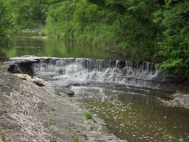
Photo of the Day - Waterfall Along Harvey's Branch Road

Photo of the Day
Waterfall Along Harvey's Branch Road
Franklin County, Indiana 

Monday, April 22, 2019

Saturday, April 20, 2019

The Agricultural and 4-H Fair - Southeast Edition

History of the 4-H County Fair - Southeast Edition

The Agricultural and 4-H Fair - Southeast Edition
The annual festival, or fair, dates back to ancient times with the Mesopotamians, Indians and Greeks. During the Middle Ages the fair evolved into a combination religious and market event with merchants selling exotic goods from faraway places as well as local farmers selling their produce. The Modern Agricultural Fair emerged when Massachusetts resident Elkanah Watson needed an event to show his prize sheep. Watson became an early advocate for agricultural fairs as educational venues for farmers. The county extension service grew out of this need for agricultural education.


Sample Chapter
Buy Direct from Author
Softbound Price - $6.99


Available In Multiple Formats - Ebook And Softbound:
Draft to Digital Universal Link
Kindle
Amazon Softbound
Barnes & Noble
Barnes & Noble - Softbound
Kobo
Google Play
Scribid
24 Symbols
Walmart Books
Apple


Wholesale Pricing Available
For more information, contact:
Mossyfeetbooks@gmail.com
Orders over $50.00 Free Shipping
Join Paul Wonning on:
Facebook
Twitter
Linkedin
YouTube
Pinterest

Paul Wonning's Books on Amazon Page
Paul Wonning's Books on Scribd Page
Paul Wonning's Books on Apple
Paul Wonning's Books on Kobo
Paul Wonning's Books on Barnes and Noble
Paul Wonning's Books on 24 Symbols
Paul Wonning's Books on Google Play
Paul Wonning's Books on Indigo
Paul Wonning's Books on Playster
Paul Wonning's Books on OverDrive
Search Paul Wonning on Ingrams
© 2019 Paul Wonning

Friday, April 19, 2019

Sample Chapter - A History of the Transportation Revolution - A Short History of Roads

A History of the Transportation Revolution
A Short History of Roads
The history of the road stretches back at least 5000 years and probably more. Satellite images have revealed depressions in the land that indicate ancient roadbeds in the lands in which the ancient civilizations of the Near East developed. The first ancient roads were undoubtedly just paths between settlements beaten hard by travelers over a long period of time. The sunken paths remain, visible by advanced satellite imagery.
The First Roads
The first roads developed from well used places like stream and river fords, mountain passes and other high traffic area. From there these early roads most likely followed game trails and natural features of the land. These early roads sometimes developed into extensive networks which connected settlements for trade and travel, though they were little more than dirt paths in most cases. The predominant traffic on these early roads would have been foot traffic. Later on horses with travois and then wagons would have traveled on them.
Ridge ways
Early roads tended to follow hill ridges, as these natural features were already well drained and usually have less dense vegetation. The soil is normally already exposed from wind action and densely packed. These roads have come to be called ridge ways. They developed above flood plains, marshes and swamps and were important in human history as conduits of trade and communication. Wind, rain and other environmental factors tend to erode away the topsoil on hills, exposing harder, rocky subsoil, rocks and boulders. The roads mostly stayed on the southern side of hills, probably because the increased exposure to sunlight made them warmer and dryer than less exposed locations. Ridge ways only descended into valleys when it was necessary to cross a stream or river. Inclines tended to be steep because little, if any, excavating was done. The road's route could vary considerably on large, rounded hills as the ridgeline was wider there and people tended to follow the easiest route, which could change with weather conditions. Loads on the two wheeled carts in use at the time tended to shift during ascents and descents, necessitating constant adjustment of the cargo.
Stone Paving
Archaeologists have discovered the first known paved streets in the Middle Eastern region of Mesopotamia. The Sumerians, Assyrians and Babylonians dominated the region at different times. The oldest roads found to date are at the Tell Arpachiyah in Northern Mesopotamia which dates from 6100 to 5400 BC. The earliest paved streets were in cities where heavy traffic soon churned the streets into clouds of dust or rivers of mud, depending upon the weather. It was up to Darius of Persia to build the first long, paved roads.
Royal Road
Darius, or Darius the Great as he is sometimes called, lived from about 550–486 BCE. Darius built a huge empire that included West Asia, the Caucasus, Thrace-Macedonia, Paeonia as well as portions of the Black Sea region, Central Asia and the Indus Valley. His empire also included parts of Egypt, Sudan and eastern Libya. The Royal Road stretched nearly 1,500 miles across this vast empire. The Greek Historian Herodotus, who lived from about 484 - c.430, wrote that “neither snow, nor rain, nor heat, nor gloom of night,” stopped Darius' royal messengers. By utilizing 111 relay stations, these royal messengers could travel the entire road in seven days. At the relay station, the messenger would find a fresh horse, food and water. This journey would normally take three months or more for ordinary travelers. Darius probably used several previous roads to build the Royal Road, improving and connecting them. He paved this road with stone. In addition to its use as the Emperor's post road, Darius could also move his army along it to stem off rebellion or invasion threats quickly. Trade also developed along the Royal Road, as merchants could carry goods over long distances. Eventually, the Royal Road would become part of the longer Silk Road.
Silk Road
The Silk Road was actually a network of roads developed by the Chinese Han Dynasty sometime around 130 BCE. The Silk Road connected with Darius' Royal Road, providing a trade route between Africa, Europe and the Middle East. In 1453 the Ottoman Turks closed access to the road during their period of conquest. The closure of the Silk Road provided impetus to a search for a sea route to China. Christopher Columbus embarked on his voyages, beginning in 1492, in response to this need in his search for a sea route to China.

Photo of the Day Laughery Creek - Ohio/Dearborn County Line

Photo of the Day
Laughery Creek - Ohio/Dearborn County Line
Laughery Creek derives its name from Colonel Archibald Lochrey of Pennsylvania. On August 21, 1781 during the latter years of the Revolutionary War Lochrey and a company of soldiers were traveling down the Ohio River to meet George Rogers Clark. Clark wanted to repeat his success at Vincennes at Detroit. On August 21, one of Lochrey's men shot a buffalo on the bank of a creek that emptied into the Ohio River. The company stopped to prepare the carcass for consumption when a band of Indians, led by Joseph Brandt, attacked. Lochrey and thirty-two of his companions died in the attack. Brandt and his warriors carried the remainder to Detroit as prisoners. Clark's dream of capturing Detroit died with Lochrey's company. An historical marker a short distance downstream mark in Riverview Cemetery marks the site of the massacre and whatever remains are left of Lochrey and his men. A government clerk misspelled Lochrey's name when they recorded the name of the creek.

Thursday, April 18, 2019

Photo of the Day - Bronze Tree Sculpture - Rising Sun, Indiana Waterfront

Photo of the Day - Bronze Tree Sculpture - Rising Sun, Indiana Waterfront
Designed by Artist Andrea Grimsley and sculpted by blacksmith and sculptor Chaz Kaiser this imposing fourteen foot bronze tree sculpture adorns Rising Sun Indiana's waterfront park. Constructed in 2005, the tree provides a stunning centerpiece for the park. 

Wednesday, April 17, 2019

Photo of the Day - Lanier Mansion Gardens Overlooking Ohio River


Photo of the Day - Lanier Mansion Gardens Overlooking Ohio River
The Lanier Mansion is an Indiana State Historic Site owned and managed by the Indiana State Museum. The 1834 mansion, built by James Lanier, is open for public tours and is well worth visiting.
History
Designed by architect Francis Costigan, the house was constructed between 1834 and 1835. During the time Lanier lived in the house, from 1844 until 1851, there were iron foundries to the north and east and hog lots to the east. The railroad station lay to the west and to the south Lanier had constructed the wharves and warehouses he needed to conduct business. The home features Corinthian columns, a spiral staircase, round doors and round, frieze windows.
State Ownership
The Lanier family owned the home until 1917, when the family donated it to Jefferson County. The State of Indiana acquired the house in 1925 to operate as a State Historic Site. The National Historic Landmark Foundation listed it on April 19, 1994.
Lanier Mansion 
601 W. First Street
812-265-3526
Madison Indiana

Tuesday, April 16, 2019

Photo of the Day - Strauther Pleak Round Barn

Strauther Pleak Round Barn
Strauther Pleak built the round barn in 1911 on an 80 care homestead. It sits in Washington Township, Greensburg, Indiana. It resembles a three-tier cake which is very unique in Round Barns in Indiana. It also features an octagonal silo in the center, a double cupola and horizontal siding. The eighteen-foot diameter silo, lined with brick and concrete, was constructed first, and the barn was erected around it. The final restoration was accomplished after the farm was purchased in 1996 by the Reed family and the help of a great team of people and their foresight. The first goal is to start a learning center for youth to learn the importance of agriculture for the future as well as to maintain a valuable heritage. The Round Barn is open for group activities. Since it opened, it has hosted visitors from Germany, Japan, Brazil, Argentina, England, France and the United States. Programs can be customized to your group needs. Some of the programs available include: History of the Barn Examples of Indiana Crops What does it take to grow crops? Agricultural Equipment-past and present Education of Weather and how it affects crops Educations of how commodities are stored and sold Games for all ages Corn Maze Story Telling To learn more about the Barn or to book a tour call: 800.373.6064 * Certified Group Friendly.

Monday, April 15, 2019

Sample Chapter - A Visit to Spring Mill - Caves and Cave Boat Tour

A Visit to Spring Mill State Park

Spring Mill Caves and Cave Boat Tour
Caves
Donaldson, Bronson, and Hamer Caves
Visitors to Spring Mill State Park have limited access to three caves inside the park. They also have an opportunity explore caves at the nearby Cave River Valley Natural Area. Guided boat ride tours inside Twin Caves are available during the summer season. These tours operate only when conditions are favorable. The boat ride travels about 500 feet into the cave, then returns to the entrance. Visitors will see several interesting features inside the cave during the tour. During periods of heavy rainfall, the tours may be cancelled due to flooding waters. The cost of the tour is nominal and only same day registration is available. Make the reservations on-site in person at the Twin Caves Shack. The tours operate from 9:00 AM through 5:00 PM daily between Memorial Day and mid-August. From mid-August until mid-October, the tours operate only on weekends and run on the half hour. The endangered blind cavefish is a common sighting on this tour.
Bronson and Donaldson Caves
Bronson Cave 1

Visitors may explore both Donaldson and Bronson Caves inside the park. Visitors must register and complete an online training course offered by IKC. This course informs potential cave visitors of methods to decontaminate before entering the caves. A disease called White-Nose Syndrome threatens Indiana bats. This fungus borne disease is killing bats in large numbers. The program exists to allow people to visit the caves, but keep the bat population safe from the disease. The caves open during special times for registered groups.
Donaldson Cave 1
Cave River Valley Natural Area 
Visitors to the park also can access the Cave River Valley Natural Area. This area is about eighteen miles from Spring Mill State Park, on Cave River Valley Road. It is north of Campbellsburg, which is east of Spring Mill State Park on Indiana State Road 60. The master plan for this facility is for hiking trails, parking, primitive camping and self-guided cave exploration. Please call Spring Mill State Park, or visit the web site to see the current conditions for visiting this new facility.

 Twin Caves Boat Tour
Open daily from Memorial Day Weekend thru mid-August, 9 a.m. to 5 p.m.
This feature bears the name Twin Caves because the water flows out of one cave and enters another a few hundred feet downstream after tumbling over a dam. Boats cannot enter the lower cave and would not be able to enter the upper one if not for the dam.
The boats designed specifically for the Twin Cave Tour. The tour ends at State Park property line at a feature called Turn Around Bend. The owner of the land above the cave has not extended permission for the tour to continue further.
The boats penetrate about 500 feet into the cave; the tour takes about twenty minutes. A dam raises the water level enough for the boats to go into the cave. Water depth ranges from three to fourteen feet.
Cave  Tours
During the summer months, the tour runs daily. The tour operates on weekends from mid-August thru mid-October 9 a.m. to 5 p.m. Tours run on the half-hour. Only same day reservations are accepted and visitors must register in-person at the Twin Caves shack. Cost is $3 per person. Children under age 3 and pets are not allowed on the tour. Food and drinks not allowed on boats. Guides pull the boats through a stream passage. They highlight cave formations and point out cave animals. Visitors commonly see the endangered blind cavefish on the tour.

Photo of the Day - Treetops Muscatatuck National Wildlife Refuge

Photo of the Day - 
Treetops Muscatatuck National Wildlife Refuge


Sunday, April 14, 2019

A History of the Transportation Revolution

A History of the Transportation Revolution
Description:
A History of the Transportation Revolution covers the history of the evolution of major modes of human transportation. The book provides interesting events in the development of walking, roads, airships, bicycles, aviation, kites, railroads, jet engines and rockets. Additional sections cover the history of canals, boats, ships and more.
Sample Chapter
Buy Direct from Author
Softbound Price - $9.99
Shipping - $3.00

Available In Multiple Formats - Ebook And Softbound:
Draft to Digital Universal Link
Kindle
Amazon Softbound
Playster
Barnes & Noble
Barnes & Noble - Softbound
Kobo
Google Play
Scribid
24 Symbols
Walmart Books
Apple

Other Books in the Series
A History of the Transportation Revolution
History of the Telephone 
A History of Time
Short History of Libraries, Printing and Language
Short History of Fire Fighting
Short History of Gardening and Agriculture
Short History of Railroads
Short History of the Discoverers
Short History of Roads and Highways
Short History of Public Parks
Short History of Political Parties
A Short History of Traditional Crafts
Short History of the Post Office
A Short HIstory of Political Parties

Wholesale Pricing Available
For more information, contact:
Mossyfeetbooks@gmail.com
Orders over $50.00 Free Shipping
Join Paul Wonning on:
Facebook
Twitter
Linkedin
YouTube
Pinterest

Paul Wonning's Books on Amazon Page
Paul Wonning's Books on Scribd Page
Paul Wonning's Books on Apple
Paul Wonning's Books on Kobo
Paul Wonning's Books on Barnes and Noble
Paul Wonning's Books on 24 Symbols
Paul Wonning's Books on Google Play
Paul Wonning's Books on Indigo
Paul Wonning's Books on Playster
Paul Wonning's Books on OverDrive
Search Paul Wonning on Ingrams
© 2019 Paul Wonning

Friday, April 12, 2019

Photo of the Day

Muscatatuck National Wildlife Refuge - Near Seymour Indiana

Thursday, April 11, 2019

Tuesday, April 9, 2019

Spring Beauty Earliest Wildflower

Spring Beauty 

Spring Beauty Earliest Wildflower
One of the earliest wildflowers to appear on the woodland floor is the Spring Beauty, begins blooming in early April. Lavender or pink veins contrast with the snow white on the blossoms, creating a lovely carpet on the forest's floor.
Common Name:
Spring Beauty, fairy-spuds
Botanical Name:
Claytonia virginica
Family:
Portulacaceae – Purslane
Sun:
Shade
Soil:
Rich, moist
Hardiness Zone:
USDA Zone 4 – 9
Propagation:
Seed
Flower Time - Southern Indiana:
April
Plant Height:
Six to twelve inches
Flower Color:
White, often tinged with pink
Southern Indiana Wildflowers

The genus name honors John Clayton (1694–1773), Virginia botanist. The species name means "Of Virginia."
The Spring Beauty is one of the first wildflowers to brighten the southern Indiana hillsides in the spring. It begins to emerge in early March, its pair of line, slender leaves wending their way up through a thick carpet of leaves. Sometimes a layer of snow slows them a bit, but by early April the show begins.

The Spring Beauty is a perennial, and it emanates from a tuber like root which resembles a very small potato. It is edible, having a sweet flavor similar to the chestnut. The Indians and early colonists utilized them as a food plant.
The wildflower show continues for about three weeks or so, the flower finally giving way to a small,
oblong capsule fruit which contains the seeds. These scatter over the ground, ensuring future generations of the Spring Beauty’s graceful display.
The name Claytonia was given to the flower by Linnaeus in honor of John Clayton, who sent him a specimen in 1757. Clayton found the flower in Virginia, thus supplying the second part of the botanical name.

Saturday, April 6, 2019

National Independent Bookstore Day

I will be one of 18 Indiana authors sharing stories and selling books at the Indiana History Center on April 27, 2019. The event will take place at the Indiana History Center from 1 - 4 PM. 
Web Page for the event:
https://indianahistory.org/press-release/ihss-independent-bookstore-day-celebration-expands-with-author-festival/


Indiana Historical Society
450 W Ohio St, 
Indianapolis, IN 46202
http://www.indianahistory.org/


Monday, April 1, 2019

Sample Chapter - Time Line of the American Revolution - 1775

Time Line of the American Revolution - 1775
April 19, 1775 - Battle of Lexington and Concord
The British troops disembarked into waist deep waters of the Charles River. As they waited to receive their rations, ammunition and other supplies, they could hear the sound of church bells sounding in the distance as the colonials rang out the alarm. Sensing that they had lost the element of surprise, the British commander sent a messenger back to General Gage, requesting reinforcements.
The Militia Waits
French and Indian War veteran Captain John Parker had gathered about eighty militiamen at Lexington to await the British advance. Parker had gotten Revere's warning and had assembled his troops in the dead of night and the men waited in the dark, wondering if Revere's warning had been accurate. About 4:15 AM, a scout arrived with the word that British troops really were on the move and had advanced to a position near Lexington. Parker did not expect the confrontation to end in battle. He positioned his men so they would not impede the British advance and ordered his men to not fire unless the British fired first. The British had executed these types of operations before and he expected that they would come, search for supplies and then return to Boston.
The British Arrive
British troops arrived about 5:00 AM in the morning to find a body of militia lined up in the town common armed with muskets, blunderbusses or any other weapon they could find. One of the British officers rode along the line, ordering the colonials to disperse. Armed with muskets and bayonets, the British would have been an imposing force. The outnumbered colonials did not disperse, thus the two forces faced a brief standoff.
Battle of Lexington
No one has determined who fired the first shot. Both British and Colonials claimed the other fired it. A bystander, there were about two hundred onlookers, could even have fired it. Someone did fire the first shot that set off the long simmering war. After the shot, the foes exchanged a ragged volley, after which the British fixed bayonets and charged the colonials. Eight militiamen died in the attack. The men quickly scattered and ran.
Mustering in Concord
Colonel James Barrett had taken command of the colonial militia forming in Concord. Reports trickled in about the actions in Lexington. Barrett, with about 250 militiamen under his command, first took up a position along the road to defend the town. Hearing reports that indicated the approaching British numbered around 700, he withdrew to the town. After further consideration, he abandoned Concord and took up a position on a hill overlooking the town. During the time he waited, more militia arrived and the size of his force grew.
March to Concord
The resistance had rattled the British troops. After the officers regained discipline, they began their march to Concord. This march also proceeded with little opposition. Upon arrival, they found Concord undefended. The British commander ordered some his troops to move to secure the bridges into town, and then he began the search for munitions. Loyalist spies informed the British the location of the few military supplies remaining in Concord. The soldiers found three cannon, some shot, barrels of flour and other supplies. They burned the cannon carriages and damaged the weapons. The barrels of flour and shot they had thrown into the millpond. The colonials managed to recover these supplies after the British left.
Battle
Colonel Barrett's troops occupied a position above the North Bridge that the British were guarding. By now, his force totaled around 400 men while the British force guarding the bridge totaled only around ninety. He decided to attack. He ordered his men not to fire unless fired upon, and advanced toward the bridge. The British, seeing the appearance of a superior force, began an orderly retreat across the bridge. Some of the soldiers began pulling up planks in the bridge floor to retard the colonial advance; however, the officer in charge ordered them to stop. The colonials began advancing across the bridge in columns while the militiamen on the other side formed into a line. A British soldier fired a shot, followed by another ragged volley. Barrett ordered his men to fire and the battle began. It did not last long as the outnumbered British broke and ran.
The Retreat to Boston
By now, the colonial force had grown to almost 1000 men. The British commander, having found few supplies and by now concerned about his troop’s safety in light of the growing colonial force, ordered a return to Boston. The march to Lexington and Concord, except for the brief confrontation in Lexington, had been largely uneventful. The return to Boston turned into a nightmare for the beleaguered British soldiers. The colonial force continued to grow. Many of these men were experienced fighters, having served in the French and Indian War and as rangers fighting the Indians. They formed an effective, persistent fighting force that harassed the British all the way to Lexington. Here, they trapped the British briefly, until reinforcements from General Gage arrived. Thus reinforced, the hungry, exhausted British continued their retreat. They arrived back in Boston twenty-one hours after they left, exhausted, hungry and demoralized. Forty British soldiers died in the day's action, while the colonials lost twenty-five. Colonial wounded totaled around nine, the British eighty.
By the end of the day, the British found themselves besieged in Boston surrounded by a colonial force that would eventually total around 15,000 men from the surrounding area and many of the other colonies.

Time Line of the American Revolution - 1775

Time Line of the American Revolution - 1775
Discover the obscure, little known actions as well as the famous ones in the Time Line of the American Revolution - 1775. This journal of the first year of the United States War of Independence reveals the important events of the first year of the colonial rebellion.

Buy Direct from Author

$12.99
$3.00 Shipping 

Timeline of United States History Box Set
Buy Direct from the Author
$60.00
All six volumes take you through colonial American history from Christopher Columbus' first voyage to the beginning of the Revolution. Explore the fascinating years that shaped the United States. 
$72 Retail Value
$60.00 - 
Shipping $3.00
Colonial American History Stories - 1215 - 1664
Colonial American History Stories - 1665 - 1753
Colonial American History Stories - 1753 - 1763
Colonial American History Stories - 1763 - 1769
Colonial American History Stories - 1770 - 1774
An American Revolution Time Line - 1775
An American Revolution Time Line - 1776
Available In Multiple Formats - Ebook And Softbound:
Draft to Digital Universal Link
Kindle
Amazon Softbound
Barnes & Noble
Barnes & Noble - Softbound
Kobo
Google Play
Scribid
24 Symbols
Walmart Books
Apple